cancelled
Category: Hiking (Page 4 of 6)
HIKING THE LEON LEVY PRESERVE
SOUTH SALEM, NY
THURSDAY OCTOBER 22, 2020
9:30 AM
The Leon Levy Preserve, formerly the Bell property, was purchased by the Town of Lewisboro in 2005. It is 383 acres of forest and wetland located in the watersheds of both New York City and Stamford. The preserve has an extensive, well marked, trail system, the ruins of the Black mansion (1899-1979) and other outbuildings. The scenery at this time of year is spectacular and the Preserve encompasses an impressive gorge and numerous large rock outcroppings.
The hike of about 3+ miles (2 hours) we will take features mostly wide and well maintained trails which range from easy to moderate levels of difficulty. This hike should appeal to hikers of all levels of experience. As always, we welcome spouses, friends and dogs on a leash. No lunch.
DIRECTIONS:
The actual address of the Preserve is 2-50 Smith Ridge Road (Route 123) but Google 45 Smith Ridge Road in South Salem, NY which is a private house on the right side of the road. Just beyond that address is a sign for the Preserve on the left side indicating a left turn into the parking lot. The location is well up Rt 123 into NY State past Vista but short of Rt 35. There is ample parking.
Contacts:
Dave McCollum and Bob Plunkett
Bob Plunkett
“HIKING” GREENWICH POINT PARK
6 TOD’S DRIFTWAY
OLD GREENWICH
Greenwich Point is a beautiful peninsula surrounded by Long Island Sound and Greenwich Cove. The walking trails are flat and well maintained which is a bonus because the scenery is just spectacular. For half of the hike the skyline of New York is clearly visible and the Greenwich shoreline and magnificent water views complete the circuit. This has always been our most popular hike of about 2.5 miles which should take us no more than one and a half to two hours. An optional lunch will follow at Applausi Osteria Toscana at 199 Sound beach Avenue in Old Greenwich, a hit with past hikers.
DIRECTIONS: GOOGLE GREENWICH POINT
Take Exit 5 off southbound I-95 and make a sharp right onto US 1 north. At the first traffic light make a right onto Sound Beach Avenue. Follow Sound Beach through Old Greenwich for 1.8 miles and turn right onto Shore Road at the T intersection. Shore Road becomes Tods Driftway and enters the park past the guard house. Park in the first lot on the right where we will meet at 10:30. Spouses and guests are invited and dogs on a leash are permitted in the park after December 1.
ATTIRE; It will likely be quite windy and cool on this exposed sprit of land so layer up!
CONTACT: David McCollum
Write up:
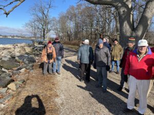 The US Postal Service has nothing on the DMA hikers—“neither rain nor snow…” oh, wait a minute, the day did not turn out badly after all! The overnight snow was still evident at 10:30 in the morning but not a footing issue and the sun came out later on the hike. A good size group of 17 including three spouses walked just short of 3 miles in an hour and a half around the spectacular property. It’s easy to see why Greenwich keeps it pretty much to residents for most of the year!
About half the group stayed on for a delicious lunch at the Beach House Café in Old Greenwich.
Again this hike, as others, give us DMAers a chance to walk and talk in some really nice places!
Next hike—Sherwood Island Park in Westport Thursday, January 12 at 10:00 AM
Dave McCollum
Bob Plunkett

TUESDAY NOVEMBER 19, 2019
HIKING POMERANCE/MONTGOMERY PINETUM PARK
GREENWICH 10:00 AM
This 100 acre property is now owned by the town of Greenwich but was originally the estate of Ernest Seaton and later the home of financier Maurice Wertheim. The estate house was demolished by the town after falling into disrepair but the stone walls remain. Mr. Seaton is credited with starting a boys group called “The League of Woodcraft Indians” which evolved into the Boy Scouts. Wertheim’s daughter, Barbara Tuchman, lived on the property and wrote the Pulitzer Prize winning book “The Guns of August” there.
This hike is really more of a walk in the woods as the trails are wide, relatively flat and well maintained. It is a very scenic property with mature trees, rock outcroppings and moving water in addition to the historical features. As the property is relatively small, our hike will take approximately 2 hours after which we will enjoy an optional lunch at Louie’s Restaurant (136 River Road Ext.) nearby in Cos Cob.
DIRECTIONS: On Google Maps, enter Montgomery Pinetum on Bible Street in Cos Cob. There is another entrance to the park but parking there is limited. Go to the Bible Street entrance. We will gather in front of the Greenhouse building at 10:00 AM.
Take I-95 south to Exit 5 and stay in left lane on the ramp to turn left at the light onto US 1 south. Proceed .8 miles across the Mianus River Bridge and turn right into Nassau Street and then a quick left onto Valley Road. After .2 miles turn right into Orchard Street and then a quick right onto Bible Street. Drive .8 miles to a left turn into Montgomery-Pinetum Park. 15-20 minutes from Darien with average traffic.
Contact: David McCollum
HIKING WARD POUND RIDGE RESERVATION
THURSDAY OCTOBER 24, 2019
10:00 AM
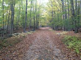
Ward Pound Ridge Reservation is a 4,000 acre park located in Cross River, NY with more than 35 miles of hiking trails over varied terrain. We will be hiking a combination of two trails totaling about 4 miles with some moderate climbing and descending on the Leatherman’s Loop section. The reward for the climb is a spectacular view of the Cross River Reservoir and surrounding territory. The trails are wide, well maintained and clearly marked. Optional lunch will follow at Blind Charlie’s Café in Scott’s Corners.
SPOUSES, SIGNIFICANT OTHERS, FRIENDS AND GUESTS ARE WELCOME
DOGS ON A LEASH ARE ALLOWED.
We will assemble at the parking lot near the Rt 121 entrance (where the ticket booth is located) at 10:00 AM sharp. From there we will drive our cars to a large parking lot near the trailhead. DON’T BE LATE!
The hike will be led by Dave McCollum.
DIRECTIONS:
Address—6 Reservation Road, Cross River, NY 10518
Using either Ct Route 124 up through central New Canaan, or the Merritt and High Ridge Road (Exit 37) proceed to the junction of 124 and 137 in Pound Ridge.
Continue north on NY 137 past the Inn at Pound Ridge and bear left at the fork, staying on 137. When 137 ends at NY 121, turn right onto 121 and follow 121 about 2.9 miles to the clearly marked right turn into Ward Pound Ridge Reservation. Proceed to the ticket booth. No entrance fee charged this time of year.
 HIKING MIANUS RIVER PARK, STAMFORD
THURSDAY SEPTEMBER 24, 2020
9:30 AM
Our first hike of 2020 will take place at Mianus River Park, a 400 acre urban forest which straddles the towns of Stamford and Greenwich and is owned jointly by them. While the hiking is not difficult, the trails are uneven and have the usual roots and rocks. Sturdy shoes and a positive attitude will prevail!
We will hike approximately 4 miles starting at 9:30 am from the Stamford entrance to the park which is at 68 Merriebrook Lane.
As usual, spouses, friends and dogs on leash are welcome. We will social distance as far as practical and masks are optional.
There will be no organized lunch after the hike.
DIRECTIONS
We will meet at 9:30 at the Merriebrook entrance to the park on the Stamford side. Merriebrook Lane is accessed off of Westover Road and both Waze and Google Maps will take you there. About 20 minutes from Darien.
There should be ample parking at the park. Do not park on any of the roads in the area, all are marked no parking and are patrolled.
Contacts: Dave McCollum and Bob Plunkett
Trout Brook Valley Hike Tuesday, June 4, 2019 at 9.30 am
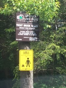 Our final hike of the season is scheduled for Tuesday June 4, 2019. We will be hiking the Trout Brook Valley Preservation Area in Weston, Ct, which is owned by the Aspetuck Land Trust. This is an 1100 acre reserve that has several trails classified as hard, medium and easy.
The area is lush green at this time of the year. No man-made or machine sound disturbs the serenity of this preserve; the only sounds you hear are of the birds twittering, the brooks babbling and the winds whistling. We will be hiking a loop of about 3.5 miles consisting of easy and moderately difficult trails. So if you wish to commune with nature, come join us in this great hike, which is not as strenuous as our last one at Devil’s Den. Sturdy shoes are required, water and bug spray recommended.
With an early start at 9.30 we should be done by 11.45 am.
Lunch will follow at Tavern On Main located at 150 Main Street, Westport.
We will be using the Bradley Road entrance to the park in Weston. Here are the directions:
-Take Exit 42 off the south bound Merritt Parkway. At bottom of exit ramp. Make a right turn onto
Rt 57 N ( Weston Road)—0.9 miles
-Turn right on Lyons Plains Road and proceed-3.6 miles
-At the fork make a slight left onto Valley Forge Road (not Davis Hill Rd) and proceed 1.2 miles
-Right on Bradley Road -0.3 to the entrance of Aspetuck Land Trust on left (after house number
18, Bradley Road)
On Google Maps, search for Trout Brook Valley Preserve, Weston or 18 Bradley Road, Weston.
As usual, spouses are welcome to join the hike.
Contact: Sunil Saksena 203-561-8601(cell) ; ssaksena44 @gmail.com
Hiking Devil’s Den Preserve
Tuesday, May 7, 2019, 10.00am
We will be hiking the trails at Devil’s Den Preserve in Weston on Tuesday, May 7, 2019 with a
10 am start. This is the largest nature preserve in SW Connecticut and extremely popular with
hikers.Owned by the Nature Conservancy, its has 1700 acres of woodlands,wetlands,ponds and
streams, and 20 miles of picturesque trails. It is home to 145 species of birds, 20 species of
mammals, and over 400 varieties of trees and wildflowers.
We will be hiking a loop of 4 miles.This trail has a moderate level of difficulty in that there are
places of gradual uphill, but these are usually followed by long stretches of flat trail. You do
need sturdy shoes as the trail is rocky in places.
After the hike, at about 12.30pm, we will head over to the Barn Door Restaurant for lunch. This
restaurant is located at 37 Ethan Allen Hwy (Rt 7), about a 10 minute drive from Devil’s Den.
As usual, we welcome spouses and significant others on our hikes. Newer members of DMA
are encouraged to join us.
Directions
Take Exit 42 off the north-bound Merritt Parkway and at the bottom of exit ramp make a right
turn onto Route 57 North towards Weston. After 3.8 miles, make a left and continue on Rt 57 for
another 1.3 miles. Turn right on Godfrey Road West and drive half a mile. Make left on to Pent
Road which ends in the parking lot for Devil’s Den.
On Google Maps use this destination address : 33 Pent Road, Weston
Contact : Sunil Saksena 203-561-8601 (cell) ssaksena44@gmail.com
HIKING BABCOCK PRESERVE in GREENWICH, CT
Thursday March 28, 2019 10AM
 The Babcock Preserve is a 300 acre tract of forested land in Greenwich, north of the Merritt. It is the largest park in Greenwich and consists of several hiking trails over a relatively easy terrain. It was acquired by the Town of Greenwich in 1972, partially by gift and partially by purchase from the Babcock Family.
The park is very tranquil at this time of the year. We will be hiking approximately 3 ½ miles which should take us till about 12.30pm.. More than half the trail is relatively flat, the rest is a gentle slope
which isn’t very strenuous.
As usual wives are invited and they will find this hike particularly enjoyable.
After the hike we will have lunch( optional) at a nearby restaurant.
Contact: Sunil Saksena
HIKING MIANUS RIVER PARK, STAMFORD
THURSDAY, November 8, 2018
10.00 am
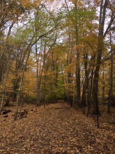 Mianus River Park is a 400 acre urban forest which straddles the towns of Stamford and
Greenwich and is owned jointly by them.At this time of the year the park is at its beautiful best.
While the hiking here is not difficult, the trails are strewn with leaves and roots and occasional
rocks, so you need sturdy shoes and a good sense of balance. We will hike approximately 4
miles and, starting at 10am, be done by about 12.30 pm. As usual, participation from spouses,
significant others and friends is welcome.
The hike will be followed by lunch at the Madonia Restaurant at 1297 Long Ridge Road, Stamford.
Directions
We will be meeting at 10 am at the Stamford entrance of the Mianus River Park which is near 68
Merriebrook Lane, Stamford. Do not go to the Greenwich entrance which is on Cognewagh
Road. Best directions can be had by googling 68 Merriebrook Lane, Stamford. There is a
parking lot on th right just across the street from mailbox for 68 Merriebrook.
Contact: Sunil Saksena
ssaksena44@gmail.com
203-561-8601 cell
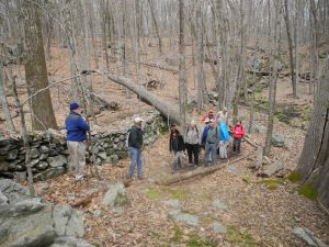
Hiking Zofnass Family Preserve in Pound Ridge on Thursday, Oct 18, 2018 The Zofnass Family Preserve in Pound Ridge is a 150 acre property owned by the Westchester Land Trust. At this time of the year it is a lush green. There are about 8 miles of trails over a rustic terrain. We will be hiking a loop of about 3 miles, which should be completed in about 2-2 ½ hours. This hike is not for beginners. The trail is
quite rugged with several ups and downs. You do need stamina and a sense of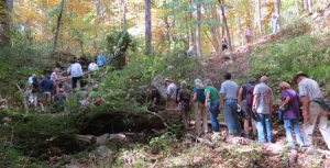 balance. Experienced hikers will find this hike in the rustic wilderness most enjoyable.
Due to limited parking space at the trailhead we will meet at 9.30 am at the Long Ridge Tavern located at 2635 Long Ridge Road, Stamford and car pool from there. Take Exit 34 off the Merritt Parkway and head north on Long Ridge Road for about 3.8 miles till you come to the Tavern on the right ( a red building just before the the blinking traffic light.)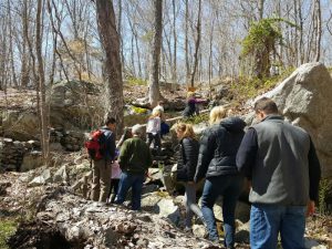
From the Long Ridge Tavern the ride to the trailhead , located at 245 Upper Shad Road is about 5-8 minutes. We expect to start hiking by 9.45 am and finish by about 12.15
pm. Its a beautiful time of the year and the hike should be a rewarding experience.
Lunch will follow at the Long Ridge Tavern for those interested, about 12.30 pm.
We welcome participation from spouses.
Dogs on leash are allowed.
Contact for this hike: Sunil Saksena 203-561-8601 ssaksena44@gmail.com
Picture from this year’s hike.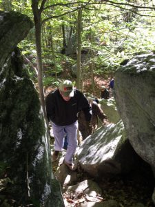
Hiking Mianus River Gorge
167 Mianus River Road,
Bedford, NY 10506
Tuesday May 29, 2018
10.30 am
 We will be hiking Mianus River Gorge in Bedford on Tuesday. May 29, 2018 at 10.30
am ( Note this 30 min later than our usual 10.00 am start).
The Gorge is a 750 acre preserve of old-growth forest that was established more than sixty years ago as the first
land project of the Nature Conservancy. While the main trail is 4 miles long, part of it has been rendered inaccessible since a short stretch runs through private property over which the owners have recently denied access to the public. Thus our hike will be a relatively short one: a 2.5 mile loop. The outbound portion of the loop consists of a couple of sustained climbs along a gradual slope. The return is largely downward. The trail is well kept, well marked and rugged in
places. Visitors have the sense of a remote wilderness in the midst of an urban area. The gorge area is quite beautiful at this time of the year with the leaves providing plenty of shade. This promises to be a particularly enjoyable hike. Spouse are welcome.
Starting at 10.30, we should be done hiking by 12 noon. Lunch for the hungry will follow at the Long Ridge Tavern, 2635 Long Ridge Road, Stamford.
Directions: ( Google maps;Mianus River Gorge, Bedford)
Proceed South on the Merritt and take Exit 34 ( Long Ridge Road).
At the bottom of the exit ramp make a right and proceed north on Long Ridge approx
7.3 miles.
Make a left on Millers Mill Road and then after crossing the bridge, make another left on Mianus River Road (a dirt road).
About a half mile down this dirt road on the left is the entrance to the Mianus River Gorge. Plenty of parking is available.
Be alert: its easy to miss Miller’s Mill Road. Check your odometer when you enter LongRidge Road from the Merritt so you know when you have traveled 7.3 miles. Two helpfullandmarks to watch for: Twin Lakes Drive on the right come just before you turn left onMiller’s Run. Also house number 116 on the right is just across the road from Miller’s Run.
Contact for this hike: Sunil Saksena, ssaksena44@gmail.com, 203-561-8601 Cell
